


Mapping Earth’s Night One Picture at a Time
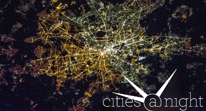
Cities at Night is a citizen science project that invites the public to help analyze nighttime images taken from the International Space Station. This valuable information helps researchers better assess light pollution across the globe. Prior to this innovative project, there were no scientific programs taking advantage of this incredible treasure trove of data.
Thanks to the Cities at Night project, all the older images have been identified and mapped. Now it’s a matter of ensuring that the project has the funding and infrastructure to continue mapping the onslaught of images that keep on coming.
Why is This Project So Important?
The information gathered from this project can be use to
- Create a detailed map that will help determine the level of lighting across the globe
- Help scientists create a better model for night sky brightness monitoring
- Identify areas where species are most threatened by artificial light at night
- Help test epidemiological cancer studies (artificial light at night has been linked to several types of disease, but vey little of the research assesses the impact of outdoor lighting)
You Can Help
Help this vital project by supporting the Cities at Night Kickstarter campaign. To learn more, check out their website or watch this video.