


New Research Strengthens Ability to Monitor Light Pollution From Orbit
by John C. Barentine, Ph.D.
Director of Public Policy
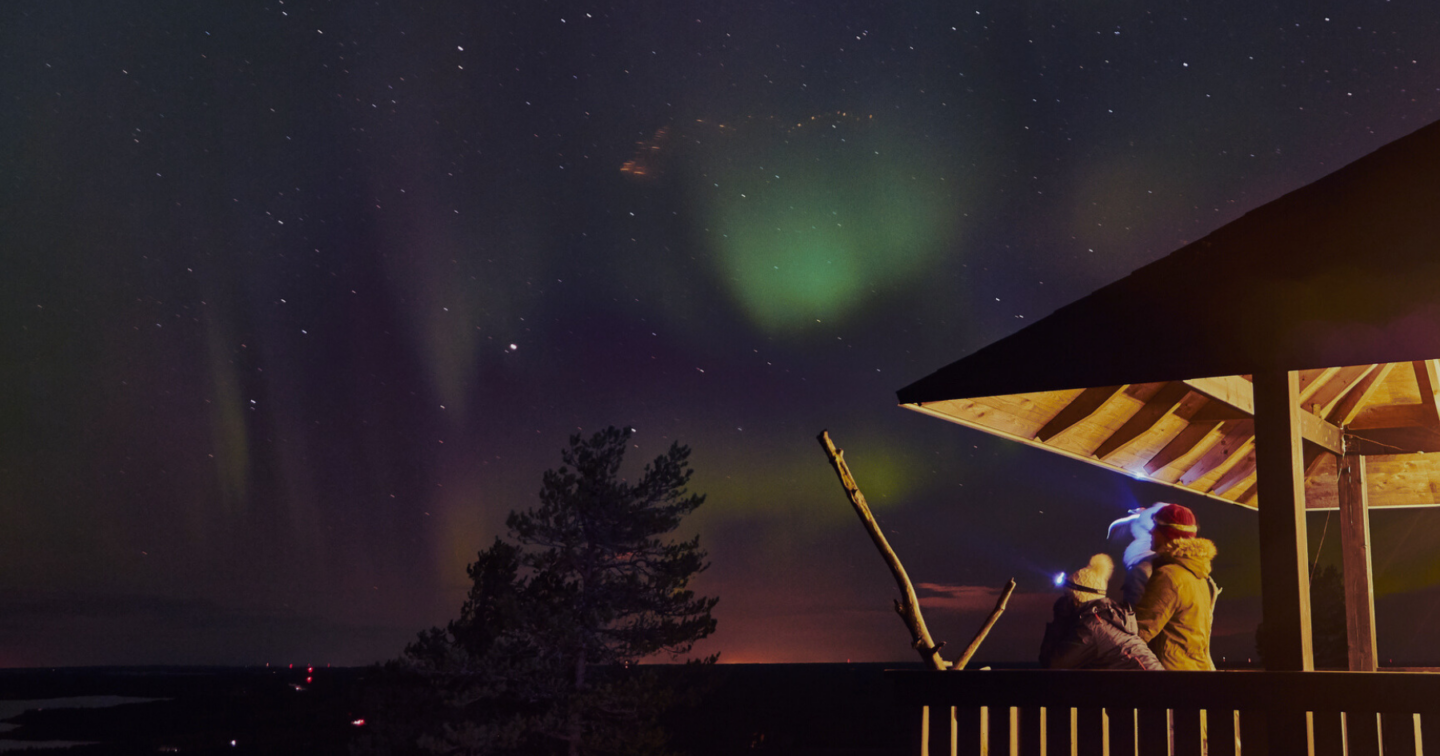
Since the beginning of the Space Age, humanity has had a bird’s eye view of our planet, both day and night. On his first space voyage in 1962, astronaut John Glenn, the first American to orbit the Earth, famously saw the lights of Perth, Australia, switched on especially so he could see them. But it was several decades into the history of spaceflight before researchers’ attention turned to systematically studying what satellite observations of the Earth could tell us about all of that human-caused light in the dark.
Of course, we now know what John Glenn and the people of Perth couldn’t know in the early 1960s: that light pollution is a serious problem. Besides the waste of energy it represents, light pollution harms the natural nighttime environment. It’s also a global issue that touches every country on Earth. But Earth is a big planet, and our ability to understand the problem is hindered by inadequate measurements on the ground. Although we understand well how to sense and quantify the brightness of the night sky, there are many reasons why we can’t easily put measurement equipment everywhere we might like: difficult terrain, political instability, and the destruction of infrastructure in natural disasters.
However, to measure light pollution on Earth, we can look down from above. Beginning in the 1970s, satellites have been launched into space with the necessary equipment for recording signals from light on the night side of Earth. This capability was at first a closely guarded secret of the United States military, but in the early 1990s the Defense Meteorological Satellite Program (DMSP) was declassified and its images of the nighttime Earth made available to civilian researchers. In the years since, other satellites followed, from great ‘earth observatories’ to inexpensive ‘cubesats’, all gathering increasingly detailed views of our planet at night.
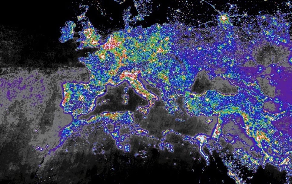
These “remote sensing” satellites have contributed in crucial ways to our understanding of the amount and distribution of light pollution around the world. The First World Atlas of Artificial Night Sky Brightness (2001) was humanity’s first truly comprehensive view of the nighttime Earth, and it revealed a remarkable amount of artificial light being emitted into the global night. Improved technology led to better satellite platforms for remote sensing, and in 2016 the atlas received a major update. The New World Atlas of Artificial Night Sky Brightness improved upon its predecessor with better resolution on the ground and increased sensitivity to faint light. It also offered the first formal predictions of the brightness of the night sky, as seen from the ground, made from orbital data. Other researchers built upon this resource with in-depth analyses that showed trends in the prevalence of light pollution on a per-country basis and gave us our most granular view of light pollution to date in certain world geographies. These results have transformed our understanding of light pollution and showed us, to quote the researchers, “the good, the bad, and the ugly” of this issue around the world.
But correctly interpreting what the satellites are trying to tell us is tricky. It’s also crucial in getting our understanding right. For example, if we want to know exactly how much light a detector senses when it’s on orbit, we need to know not only how it performs in the laboratory, but also how it functions when it’s in the “field” of outer space. That turns out to be a very challenging task. We also suffer somewhat in that the resolution of most observations obtained to date from orbit is relatively low; at best we can only resolve light sources down to the level of about an individual city block (with the notable exception of images taken by astronauts aboard the International Space Station). This makes it difficult to tell apart sources of light separated by less than such a distance.
The most stubbornly persistent issue with satellite remote sensing observations of night lights is a “haze” of light seen around cities: is it real, or is it an illusion introduced by the optics or the electronics of our satellite-based cameras? The haze is illustrated in the false-color image below, showing a satellite image of the city of Chicago, U.S., and adjacent Lake Michigan. Although we know there is no light being emitted over the lake, the purple tones indicate light sensed by a satellite that seems to get fainter at larger distances away from the city.
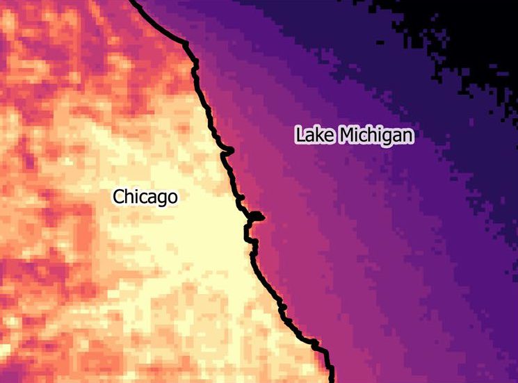
For nearly 30 years, the haze was thought to be the result of sensing very bright light coming from cities, causing the digital detectors to “saturate”. Note that the city center of Chicago, just below and to the left of the image above, registers as a solid yellow color: so much upward-directed light originates there that the satellite detector is overwhelmed and can no longer provide information about how the light is actually distributed. If that “extra” light over the lake is not real, we might be over-counting light emissions from those areas and get the wrong answer. But if the light is real and we discard it as an artifact, it causes those areas to be under-counted and makes some palaces on Earth appear darker than they really are.
Brand-new research by Alejandro Sánchez de Miguel (University of Exeter, UK) and co-workers contends the haze is real light from cities, scattered up to the satellites, and that it should be included in our measurements. They demonstrated this by matching satellite observations to data from a network of ground sensors taken at the same time, showing a very strong correlation. By accounting for the scattered light, the authors improved on the sky brightness predictions from the New World Atlas of Artificial Night Sky Brightness and can make more accurate estimates of sky brightness anywhere in the world. “The diffuse light around cities in nighttime satellite imagery of the Earth has often been interpreted as instrumental error,” they write. “Here we have shown that this is not the case.”
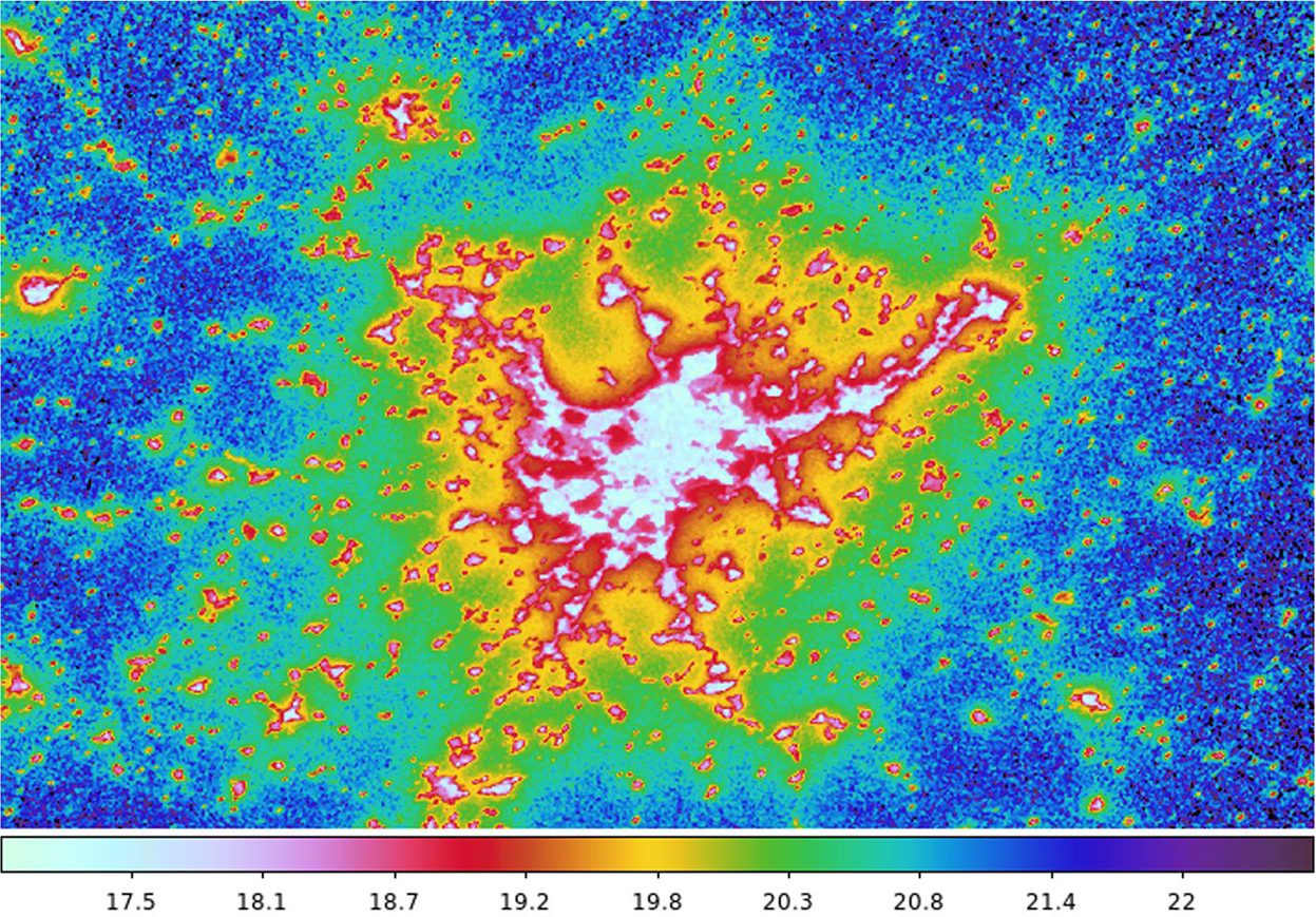
They have made available to the public an early version of a website where users can see trends in predicted night sky brightness at any location. The example below shows the city of Madrid, Spain; the false colors indicated by the color bar correspond to the predicted brightness of the night sky one would see from each location on the map.
The researchers caution, however, that at this stage the relationship between satellite readings and night sky brightness in cities is not yet fully understood, and that their models currently do not predict the sky brightness in cities very well. Work continues to better understand the relationship between the amount of light emitted by cities, as seen from the vantage point of orbital satellites, and the amount of skyglow residents of those cities experience.
Why is this new result important? Again, quoting the authors: “It should be possible for a future space-based imaging radiometer to monitor changes in the diffuse artificial skyglow of cities.” As the world’s population becomes increasingly urban, cities are where light pollution’s influence is growing the fastest — especially in developing economies. Accurate estimates of light pollution made from satellites can help us follow the evolution of the threat without relying as much on ground-based monitors.
It also indirectly makes a case for a new, dedicated ‘night lights observatory’ spacecraft mission designed specifically for that purpose, whereas satellite capabilities to date have largely included the ability to measure light pollution almost as an afterthought. For example, the latest satellite sensor with global coverage, the Visible Infrared Imaging Radiometer Suite Day-Night Band (VIIRS-DNB), is almost completely insensitive to the strong blue-light emissions of white LED lighting products. As a result, the VIIRS-DNB has largely missed the rise of the lighting technology that is quickly coming to dominate light pollution in many countries. A dedicated night lights mission that overcomes these technical challenges could be the key to identifying the parts of the world most in need of attention in our ongoing effort to fight light pollution.
View Full Research Press Release